
Data management, visualisation and communication
One of BlueSphere's core values is simplicity - we like to communicate simply and clearly. When it comes to conveying expert knowledge to our clients, a picture can say a thousand words - that's why we have a team of Geographic Information Systems (GIS) specialists who create visual representations of real-world situations, enabling a deeper understanding of the issues at hand. This is underpinned by robust data management practices, enabling consistent and effective analysis and high-quality visual outputs that are easy to understand. Meaning these can be utilised throughout the project lifecycle, enhancing project outcomes.
Our spatial information experts leverage the powerful tools within GIS to answer project questions using spatial data analysis and modelling. These techniques can be used for a wide range of tasks such as site selection, risk assessment, temporal land use analysis, spatial planning and predictive modelling. Enabling informed decisions and simple but effective communication to all stakeholders.
Our specific capabilities includes:
Data Management
Spatial Data Analysis
Data Visualisation
Cartographic Production
Spatial Solutions and Web Development Remote Sensing
Conceptual Site Models
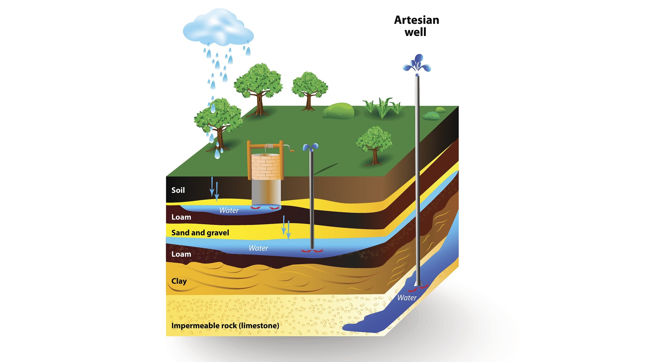
Hydrogeological Cross Sections
Temporal/Spatial Modelling
Constraints Mapping for Site Selection
Multi-Criteria Analysis for Risk Assessment
Contaminant distribution mapping
Contamination plume modelling,
Groundwater modelling